Posts by Provisuell
The “weiß-blaue” path
The “weiß-blaue” path A local history trip through the Dreiburgenland The “weiß-blaue” path Why search every low and high, when good things could not be closer by The white and blue information pillars in Tittling and Witzmannsberg point out striking points in the communities. Did you already know, for example, that there are dinosaurs…
Read MoreUp to date …
In unserer Rubrik “Aktuelles” halten wir Sie in Zukunft auf dem Laufenden, über den Tourismusverein Dreiburgenland e. V. und seine Mietglieds-Gemeinden.
Read MoreMushroom path (Schwammerlweg)
Mushroom path Not just for mushroom hunters an attractive tour The Mushroom Path (Schwammerlweg) (Number 14 in the Dreiburgenland hiking map) approx. 6 km, 2.5 hours, 440-608 m ascent Starting point: Tittling, district of Rothau, fountain at the forest car park at the “Seehof Tauer” inn Following the marking, the path leads us through pine and…
Read MoreGold trail
The gold trail In the footsteps of the gold panners The gold trail (Nr.15 in the Dreiburgenland hiking map) Circular hiking trail, approx. 12 km, 3 hours In order not to let the historical gold deposits in parts of the municipality of Witzmannsberg and the Tittling market be forgotten, the gold trail was designated in…
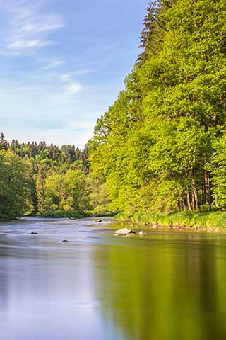
Read MoreHiking in the Ilztal
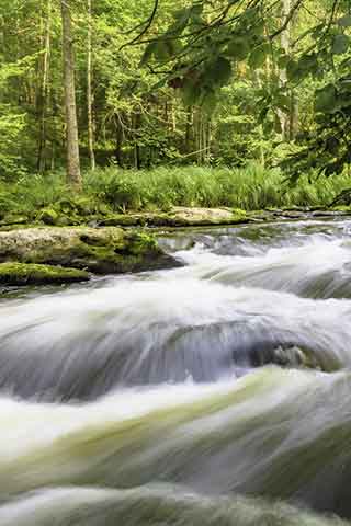
Hiking in the Ilztal Wild waters, silent forests The hiking trails in the Ilztal Natural beauty with white water, romantic paths and delightful places to relax. Circular hiking trails on the Ilz: Schneidermühle – Dießensteiner Mühle and back 5 km, car park Schneidermühle Schneidermühle – Schrottenbaummühle and back 10 km, car park Schneidermühle Schrottenbaummühle -…
Read Moreopen-air museum Bayerischer Wald

open-air museum Bayerischer Wald more then 160 historic houses the historic open-air museum One of the biggest attractions in the Bavarian Forest Important NOTE: Due to the corona pandemic and the resulting restrictions, there may be deviations in the opening times. Please also refer to the respective website for information about the current opening times…
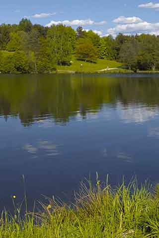
Read MoreDreiburgensee hiking trale
Dreiburgensee Wanderweg Komm, lass uns zum Schwimmen gehen … Der Dreiburgensee Wanderweg (Nr.11 in der Wanderkarte Dreiburgenland) ca. 2,5 km, 0,5 Std., 450-536 m Ausgangsort: Tittling, Dreiburgenstraße, Einfahrt zum Aldi-Markt, Zauneck links Der Weg beginnt am Zauneck links vom Aldi-Markt und führt durch ein Wiesental hinunter nach Rothau und von dort weiter zum Dreiburgensee und…
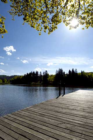
Read MoreLake Dreiburgensee
lake Dreiburgensee A lake with so many possibilities fun and relaxation charming in every season idyllically situated Waldsee, correctly called Rothauer See, is located directly at the Bavarian Forest Museum Village, approx. 3 km from Tittling in the Rothau district. The 8 hectare water area is ideal for swimming, boating and fishing. The Dreiburgensee offers…
Read MoreRocking stone
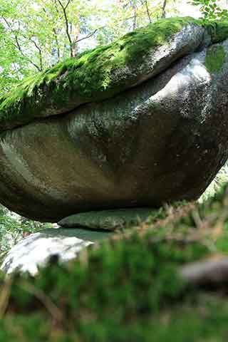
Rocking stone Are you strong enough? The rocking stone natural monument A rare phenomenon The rocking stone is a large boulder with an edge length of around 3-4 meters, a flat top and a curved bottom, which rests on an almost flat rock slab. Despite its weight of at least 50 tons, a single strong…
Read MoreSmal Aschenstein
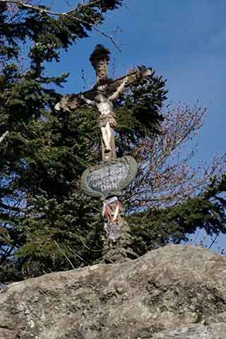
The smal Aschenstein an unexpected prospect The smal Aschenstein an unexpected prospect Hiking trail to the small Aschenstein Circular hiking trail, length 14 km, hiking time 3 hours, 520 m ascent Between the Geißlstein and the Aschstein, this viewing rock rises 913 m from the Bavarian Forest. In the foehn situation you will be rewarded…
Read More